


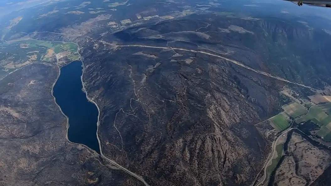
An aerial view of Monte Lake and part of Westwold around August 21, 2021. (Photo by Dale Maher)
A Kamloops pilot got a front seat look at the “blight on the landscape” where massive wildfires have burned, and has shared that with the greater public.
Dale Maher flew out of the Kamloops Airport last weekend and with four Go-Pros on his plane, he captured the Tremont Creek fire and the White Rock Lake fire from above.
He’s been posting his flight videos for more than a year, usually of the scenic beauty of this area he says, but his latest video has been his most-watched, having been viewed more than 46,000 times.
“I wasn’t going out looking for devastation, I’m not looking to exploit anybody’s misery. I was more concerned. I mean these things have been burning for so long now, for weeks and weeks. And I was just kind of more curious about what the extent of the damage was to the landscape,” Maher told NL News.
“When I got out towards Monte Lake, it was becoming a lot more evident that the area had suffered a lot more damage in a much smaller, more localized area. The town itself, it’s well known what happened there, and whole sides of hills were just scorched in black or brown.”
Maher says in flying over those fires, he was struck by the “randomness” of how they’ve burned in some places, completely scorching some areas but sparing others.
The White Rock Lake fire and Tremont Creek fire have burned a combined 145,000 hectares. The White Rock Lake fire has also destroyed more than 100 homes.


Comments